Iwate Prefecture
- Published on : 08/07/2013
- by : Japan Experience
- Youtube
Japan's Regions: Iwate Prefecture 岩手県
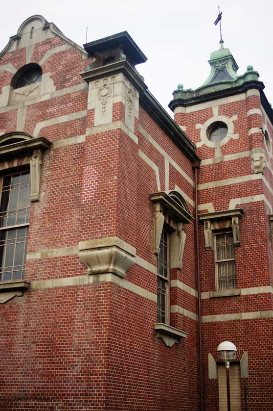
Bank of Iwate, Nakanohashi, Morioka
Iwate Prefecture, located on the north east coast of Honshu is the second largest prefecture in Japan after Hokkaido and the prefecture with the second lowest population density - also after Hokkaido.
Morioka is the largest city in Iwate with a population of over 300,000 inhabitants and the capital of the prefecture. Morioka is known for its production of iron kettles (tetsubin) and its wanko soba.
The historic temples of Hiraizumi are UNESCO World Heritage listed and this picturesque town is one of the major tourist attractions of the prefecture.
Other important towns and cities in Iwate Prefecture are Hachimantai, Ninohe, Kamaishi, Ofunato, Tono and Ichinoseki.
Iwate has cooler weather in the summers and a visit here in July and August is a welcome escape from the heat in Tokyo, Osaka, Nagoya and Kyoto to the south.
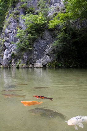
Geibikei Gorge is a beauty spot in Iwate Prefecture easily reached from both Morioka and Hiraizumi
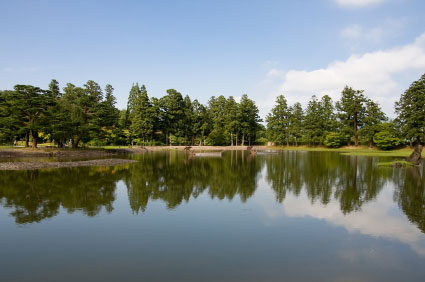
Temple lake in Hiraizumi, Iwate Prefecture
Iwate Attractions
Iwate offers skiing in winter at a number of ski resorts including Appi Kogen Ski Resort near Hachimantai. Iwate's natural attractions include Mt. Iwate, which somewhat resembles Mt. Fuji, and is the highest mountain in the prefecture, the Kitayamazaki Cliffs on the northern Rikuchu Coast, hot springs (onsen) at Tsunagi, Hachimantai, Appi, Shizukuishi, Geto Kogen and Ichinoseki and the beautiful Jodogahama Beach.
Ryusendo Cave is a large limestone cave which is open to the public and includes the Ryusenshindo Science Museum.
Iwate Prefecture is home to a number of picturesque rivers and gorges including Geibikei Gorge, which can be toured by boat, the smaller Gembikei Gorge on the Iwai River and Basenkyo Gorge on the Mabechigawa River.
Iwate still retains some of its original beech forests which can be seen in the Towada-Hachimantai National Park.
Iwate History
The early history of what is now Iwate Prefecture saw the Yamato clan trying to extend its influence north into the area in the 9th century. Yamato forces were engaged in conflict with the indigenous Emishi people. The prefecture has a number of sites dating from the Jomon Period.
The haiku master, Basho, wrote about his travels in this remote region in the late 17th century Edo Period in his work Oku no hoshomichi (The Narrow Road to the Deep North). During the Edo era Iwate was known as Mutsu Province.
Iwate's economy is heavily based on agriculture and fishing. The fishing sector was heavily damaged by the earthquake and subsequent tsunami in March 2011.
Access
Air
Flight connections from Hanamaki Airport south of Morioka to Osaka, Sapporo, Nagoya and Fukuoka.
Train
Morioka is on the Tohoku Shinkansen Line from Tokyo and Ueno Station. The journey from Tokyo to Morioka is 2 hours, 30 minutes. The Akita Shinkansen runs to Akita (90 mins) from Morioka via Lake Tazawa and Kakunodate.
Bus
There are highway buses from Morioka Station overnight to Tokyo (7 hours, 30 mins) and during the day to Sendai (2 hours, 30 mins), Aomori (3 hours) and Hiroshi (2 hours, 30 mins). There is a loop bus departing from Morioka Station 100 yen for a single journey and 300 yen for a day pass. The loop bus is convenient for many of Morioka's sights. The Tohoku Expressway from Hiraizumi and Mizusawa runs north to Morioka.
Ferry
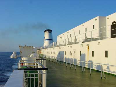
The major point of access to Iwate is by ferry to Sendai in Miyagi Prefecture to the south. There are ferries to Nagoya and Tomakomai on Hokkaido from Sendai-ko (local JR train to Tagajo station on the Senseki Line then a taxi, bus or 15-20 minute walk).
Books on Japan
Iwate Prefecture: read a travel guide to Iwate Prefecture in northern Tohoku including the cities of Morioka and Hiraizumi.
