The village of Soni 曽爾村
- Published on : 01/02/2018
- by : I.D.O.
- Youtube
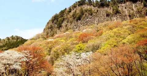
Byobu iwa in spring at Soni
coniferconifer, Flickr
A color palette
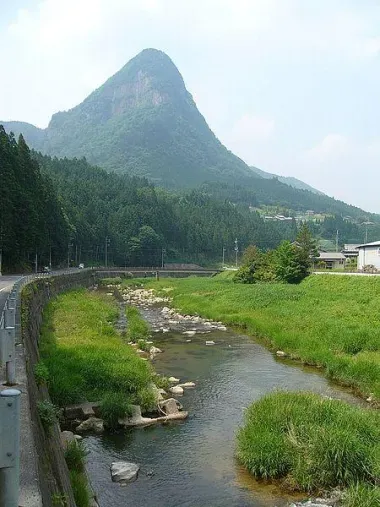
Soni is a small village of 1,500 inhabitants, nestled in the hollow of a narrow valley carved out by the River Shorenji, in the Uda region in the northeast of Nara prefecture. It has been designated as one of the most beautiful villages in the Japanese countryside.
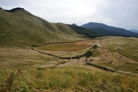
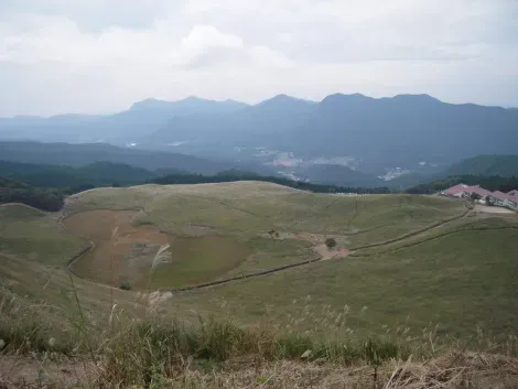
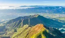
The village is known for its mountainous landscapes and magnificent views of the surroundings. More than 80% of Soni's forests are part of the quasi-national Murô-Akame-Aoyama Park. Its plateau, Soni Kogen, and its mountains attract visitors and hikers throughout the year.
Read : The village of Minamioguni
SoniKogen: a highly protected platform
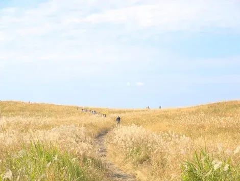
Located on the border of Nara and Mie prefectures, the Soni Plateau ( Soni Kogen ) is made up of 40 hectares of grassland and wetlands that extend over part of what was the crater of Mounts Kuroso and Kameyama. The meadow is covered with pampas grasses that the ancient inhabitants cultivated to make straw which was used, among other things, for the construction of thatched roofs. The latter have disappeared, replaced by tiles or more modern materials. However, thanks to the villagers, the reeds continue to beautify the meadow and the plateau has become a protected natural area . It is at its most beautiful in the fall , especially November, when its reeds are tinged with half-silver, half-gold tones and the sunsets set the meadow ablaze. From mid-September to the end of November, during the Yama Akari festival, hundreds of lanterns illuminate the paths that cross the fields of pampas grass, giving a magical atmosphere to the site.
Read also : Norikura Kogen's set
At the foot of the plateau, the Okame no Yu hot spring is a very popular spot with its indoor and outdoor pools offering views of the Kabuto-dake and Yoroi-dake mountains and the surrounding countryside. There is a restaurant there.
The Soni Kogen Farm Garden complex, right at the Soni Kogen bus stop, includes restaurants and shops selling local produce. You can taste the beer brewed on site, Soni Kogen Beer. Not far from there, the Soni Kogen Okome-no-Yakata bakery sells delicious breads made from rice flour. What to be ready for the hike of the surrounding sites.
See: Top 5 hikes to do in Japan
From rocks to rocks
If the village of Soni is built in a valley on the banks of the Shôrenji river (also called Soni), its surroundings are very mountainous and the following sites attract walkers, photographers and hikers:
Byobu-iwa is a volcanic cliff 2 kilometers long and 868 meters high. However, it is its 200 meter high slope that attracts visitors. Byobu-iwa means "the rock folding screen", because of its shape which is reminiscent of that of the old Japanese paper screens. Mountain cherry trees - planted by the villagers more than a century ago -, rhododendrons and a multitude of trees color its sections with different colors depending on the season. You can admire this unique landscape from the park laid out at the foot of the cliff. When the mountain cherry trees are in bloom (usually mid to late April), a bus service is organized by the villagers and the site is illuminated. On the other hand, private vehicles do not have access to the car parks of the park on evenings of illumination. Byobu-iwa was declared a "National Natural Monument" in 1959.
Kotaro-iwa , north north of Soni village, is a cliff about 200 meters high and 700 meters wide, famous for its fall foliage and rock that looks like a lion's face.
To read : Kôyô, autumn in red and gold
For hiking enthusiasts, the ascent of Yoroi-dake ("armor peak") 894 meters, and Kabuto-dake ("helmet peak") 920 meters, is easily achievable in one day and allows have splendid views.
Address, timetable & access
Address
Timetable
Soni is quite poorly served and it is more convenient to get there by car (30 minutes from Murou). Buses from Nabari Station, JR Nara Station, and Kintetsu Station, however, serve the plateau in high season (Spring, Summer, Fall).


